
Hiking Wind Tower: One of the best viewpoints in Kananaskis Country

by Craig Copeland
Craig Copeland is co-author, with his wife Kathy, of numerous guidebooks including Where Locals Hike in the Canadian Rockies, The Premier Trails in Kananaskis Country and their newest book, Heading Outdoors Eventually Leads Within.

Mt. Lougheed and Windtower (right). Photo by Marjory Gibney.
The Windtower — if you glimpse it while driving the Trans-Canada just south of Canmore — looms like a monster in a child’s nightmare. It’s so sharp and vertical that hiking to the summit seems laughably impossible.
Yet Windtower is hikeable from the other side. Starting at Spray Lakes Reservoir, a trail ascends to West Wind Pass. From there, a boot-beaten route leads to the summit, which grants an aerial perspective of the Bow and Spray Valleys.
If you can stay on course where the route is vague, and if you can surmount a couple of short pitches that qualify as “easy scram- bling,” you’ll soon be standing atop the intimidating fang.
The name Windtower is apt: expect a gale up there. If you hunker behind the rock wall erected by previous summiteers, maybe the wind won’t rip the pastrami out of your sandwich.
It’s a calm day? You’re lucky. You can stand tall and peer down the tower’s north face without becoming airborne.

Photo by Jody Goodwin.
BEFORE YOUR TRIP
Though the trail to West Wind Pass is usually snow-free by mid-April, it’s closed when bighorn sheep are lambing (April 1 through June 15). This closure also helps prevent hikers from encountering the grizzlies that frequent the area during the birthing season.
Save time and energy by studying the mountain from the trailhead: West Wind Pass is left (northeast), hidden in the forest; Mt. Lougheed is right (east); Windtower is between them. Notice how the upper edge of the tree line forms an arc beneath the tower and the mountain.
At the apex of that arc—right of the rock bands and beneath Lougheed’s left shoulder—you can see the boot-beaten route ascending into the scree. If you prefer to hike rather than climb, that’s how far right (south) you must traverse from the pass before making any significant elevation gain to Windtower.

Photo by Jody Goodwin.
BY VEHICLE
Reset your trip odometer at the Canmore Nordic Centre entrance. Resume ascending Smith- Dorrien / Spray Trail (Hwy 742). Pavement soon ends. Cross Whiteman’s Gap. Proceed southeast. Continue to 18.5 kilometres. Park in the pullout on the right (west) side of the road, just north- west of Spurling Creek, at 1,707 metres.
ON FOOT
The trail departs from the far (east) side of the road then ascends generally northeast above Spurling Creek. Break out of the trees to enter West Wind Pass at three kilometres, 2,085 metres.
The northeast edge of the pass plunges into Wind Valley. The pass is between the vertical faces of 2,680-metre Rimwall (left / northwest) and 2,695-metre Windtower (right / east).
Just below the west edge of the pass, where the trail levels in grass, look right. A right (east) fork curves to ascend southeast. That’s the route to Windtower. A few paces farther, ignore another right fork descending south into forest.
The Windtower route is evident most of the way. Where it fades, watch for cairns. If the route is unapparent, carry on as long as the going is reasonably easy. If the hike becomes a continuous scramble, retreat and find a more inviting way forward. The correct route poses no serious obstacles.
The first leg is a long southward traverse, well below and far past the Windtower summit. Your elevation gain will remain gradual except where you must surmount low, rocky outcrops. Be patient. Keep hiking generally south.
At 2,260 metres, about 50 minutes after departing West Wind Pass, angle left (east) and temporarily aim for Mt. Lougheed. Begin a more aggressive ascent now, because you can do so without your feet needing assistance from your hands.
Soon, you’ll reach the boot-beaten scree section of the route that you saw from the trailhead. After a steep pitch, the route turns north, directly toward Windtower. It’s a scree slope the rest of the way, but the grade eases and remains consistently efficient. Top out on Windtower about 1.75 hours after departing West Wind Pass.
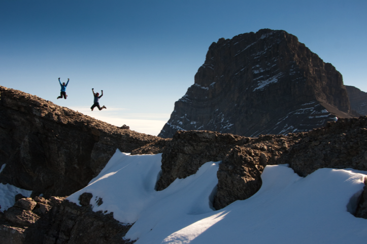
Photo by Jody Goodwin.